Editors' rating |
|||||||
GPS Map Camera: Geotag Photos & Add GPS Location Specifications
|
Track live location and add extended geodata to your captured photos.
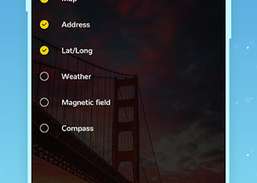

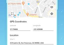

Whether It's your travel memories or your Visit at particular place, with GPS Map camera stamp application, add Date time, Map, Latitude, Longitude, Altitude, Weather, Magnetic field, Compass to Your Camera Photos. Track Live location along with your captured photos by GPS Map Camera: Geotag Photos & Add GPS Location Application. Send your Geo Location of Street / Place added photos to your Family & Friends, and let them know about your best Earth travel memories. How to add GPS map location on photos? Install GPS Map Camera: Geotag Photos & Add GPS Location Application in your SmartPhone Arrange Formats of Stamps, Change Settings according to Your requirement of GPS map Location Stamp Add GPS Location stamps automatically to your clicked pictures
Friend Locator & Route Finder is best router finder, driving route finder, Around me near by places finder and friend finder application.
Mc Leans taxis have undergone significant changes in 2013 to add to this we have launched I phone app to allow you to book and track your taxi...
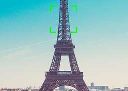
Show on your camera in augmented reality the mountains, peaks and hills.- Knows position, height and distance of few 400.000 peaks worldwide.