Editors' rating |
|||||||
The PHIVOLCS FaultFinder Specifications
|
This app shows the distance from a chosen location to the nearest active fault.
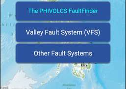
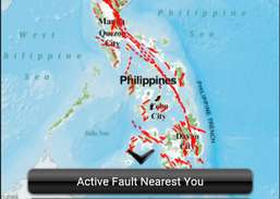
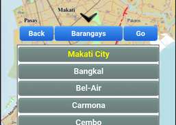
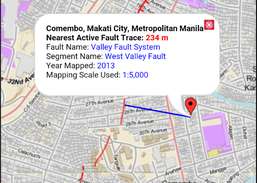
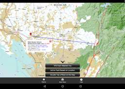
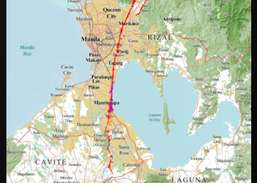
FromJoel Bandibas:The PHIVOLCS FaultFinder mobile app shows information about the distance between the user's current location, address or selected location on the map and the nearest active fault. This app needs internet connection to access the web-based active fault database of PHIVOLCS and the necessary web services. The database provides the backend source of information for the Web Map Service (WMS) and Web Processing Service (WPS) used for displaying the active fault map and querying fault trace locations, respectively. This app uses three base maps, the Philippine Geoportal Map, Google Maps and the OpenStreetMap, which are served as web services provided by the data owners. The Philippine Geoportal Map is provided by the National Mapping and Resource Information Authority (NAMRIA) of the Philippines
Download
This travel guide provides information about the best of Seychelles islands.
Find GPS, navigation, route, directions, maps, location, traffic.
The BC Ale Trail app rewards you for exploring British Columbias craft brewery destinations and the super, natural landscapes that surround...
Map of Tokyo offline works without connecting to the Internet. No need to pay for internet in roaming.