MarineTraffic displays near real-time positions of ships and yachts worldwide.
MarineTraffic displays near real-time positions of ships and yachts worldwide.
Connected to the largest network of AIS receivers, the app covers most major ports and shipping routes.
- View VESSELS ON THE LIVE MAP, search for ships, boats and seaports and see what's near you!
- More than 100,000 VESSELS PER DAY report their positions via MarineTraffic AIS
- View live wind and 48-hour ...
Redirecting to a secure site. We are checking If the link is working. Please wait...
You can report broken links into broken@dailydownloaded.com. Our editors will review them shortly.
Find any location and the shortest distance to it.
Keep track of every your steps.
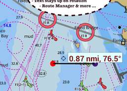
This App offers access to CHS marine vector & raster charts.
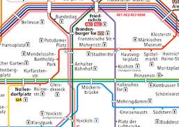
Offline line maps for Berlin (BVG).
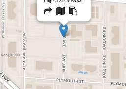
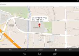
GPS Coordinates Finder is an application that finds your position and shows your coordinates on the map as latitude - longitude values in...
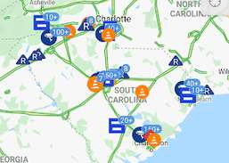
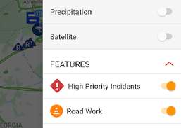
The South Carolina 511 mobile application provides real-time access to traffic and traveler information supplied by the South Carolina...