Free Nautical Charts Specifications
|
Marine Ways Boating is the ultimate marine navigation and planning application.

Marine Ways Boating is the ultimate marine navigation and planning application! In this application you will gain access to:
FREE NAVIGATIONAL CHARTS
- United States charts provided by National Oceanic and Atmospheric Administration (NOAA)
- New Zealand charts provided by Land Information New Zealand (LINZ)
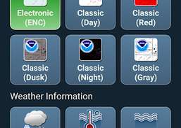
Chart types:
- NOAA Electronic Navigational Charts (ENC) (NOAA's newest and most powerful electronic charting product).
- NOAA classic charts (including Day, Red, Dusk, Night, and Gray versions).
- LINZ charts (available in Day, Dusk, and Night versions only currently)
ROUTE PLANNING TOOLS
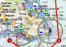
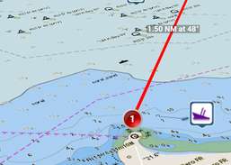
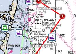
-Route Plotting. Tap and hold on the map for one second to plot your waypoints. To form a route, continue to tap and hold on the map in different areas. Distance and bearing are conveniently calculated and displayed for each leg as you add, adjust, or remove waypoints.
Compass Pro, a professional compass for optimal orientation in any terrain.
Digital Compass Free Smart Compass for Android shows the accurate direction of North, South, East and West with Longitude and Latitude.
This application is GPS and coordinate systems helper especially for military personnel.